Strava Updates Heatmaps – Gravel and Mountain Bike now included
As the title says, Strava has just added more sport-specific heat maps. These granular breakdowns of sport type add more interest and relevancy to the data. The reason is that you and I need to make a bit more effort to choose GRAVEL RIDE rather than the more generic RIDE.
More/via: Detailed GPLAMA Explainer Video
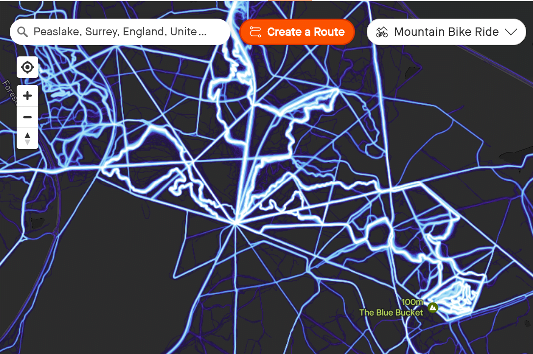
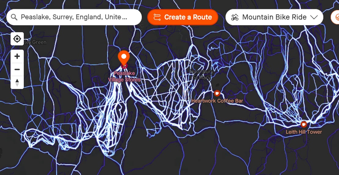
Here are two great examples of densely packed MTB rides at PEASLAKE and SWINLEY FOREST in the UK. These images use the dark mode map on my subscriber account to clearly show the heat data.
Take Out
This is great data for satisfying your thirst for two-wheeled knowledge in your local area or elsewhere.
However, it provides an excellent way to get much more reliable data for the specific sport you plan to do. Sure everyone in the SW of England probably knows those two MTB locations but the same data will be good at less frequented sites too. It’s a great way to find new places to explore, slightly further afield than you’d normally travel.
More: This link goes directly to your heatmap page at Strava.com on a browser. Non-subscribers should get most of the new heatmap insights…you might lose personal heatmaps and street-level heatmaps.
Last Updated on 29 May 2026 by the5krunner
My favourite kit and nutrition
- Injinji – Runners protect your toes. Avoid discomfort and minor injury. Run more. run faster. I use them.
- Garmin 90-degree charging adapter — the small adapter that keeps your charging cable tidy at the stem. Essential for race day. I use one.
- Garmin charging puck — the fastest and most reliable way to top up your Garmin before a session. I use one.
- Ravemen FR300 — front light that mounts directly under your Garmin or Wahoo head unit. Keeps your bars clean and your beam pointed where it matters. I use one.
- Body Glide – The Blue anti-chafe stick that all swimmers and many runners use. I use it.
- Maurten — the race nutrition trusted by elite athletes. Gels and drink mix engineered to be easy on the stomach. I use them.
- Garmin Varia RTL515 — radar rear light that alerts you to vehicles approaching from behind. Pairs with your Edge or Garmin watch. I use this model.
- Favero Assioma Pro RS2 — the power meter pedals most serious cyclists end up choosing. Accurate, easy to move between bikes. I use this model.
Reader-Powered Content

This content is not sponsored. It’s mostly me behind the labour of love, which is this site, and I appreciate everyone who supports it.
Support the site: Follow (free, fewer ads) · Subscribe (paid, ad-free) · Buy Me A Coffee ❤️
All articles are written by real people, fact-checked, and verified for originality. See the Editorial Policy. FTC: Affiliate Disclosure — some links pay commission. As an Amazon Associate, I earn from qualifying purchases.
tfk is the founder and author of the5krunner, an independent endurance sports technology publication. With 20 years of hands-on testing of GPS watches and wearables, and competing in triathlons at an international age-group level, tfk provides in-depth expert analysis of fitness technology for serious athletes and endurance sport competitors. ID

This sounds like good news for finding out about ‘secret’ off-piste MTB trails. Quite understandably, local MTB trail builders and riders do not officially post their trails as public courses or segments on Strava, nor as marked trails on Trailforks, so they can be hard to find. To date, I’ve used the MTB specific heat maps via my Trailforks Pro subscription to find those hidden gems of MTB trails in a new area; but now Strava is separating out the generic cycling chaff from the MTB specific wheat, that might finally be the value option that tips me back to paying for Strava premium (only if it turns out to be substantially better than Trailforks though, as their annual Pro subscription cost is a fraction of Strava premium)
yup