 Strava – Big Changes in 2021…starting with this
Strava has some ‘big’ changes for us later this year and we can perhaps get some hints of part of that from what they have just released today. I’ve had a quick chance to play with it, so I’ll give you a quick explainer and then have a go at suggesting what might follow later in the year – that will be speculation as I don’t know for sure!
Let’s go…
3D Personal Heatmaps – web only, subscriber-only
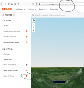
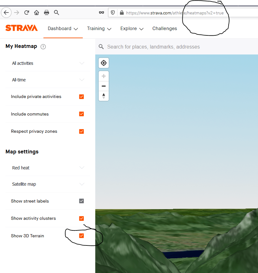
If you start up your desktop web browser and head over to the Map Settings of your Strava Personal Heatmap, subscribers should see a new 3D Terrain option. If you check that then you should get a new satellite view of your personal rides & runs. The URL and settings should look like I’ve shown on the above image to the right.
It’s neat though. You can check out some of your hillier rides and see how the routes you covered match the terrain. Here’s one of my rides in the Alps at Morzine a while back. You can see that I’ve changed the pitch of the map by holding the CTRL-key whilst zooming with the mouse.
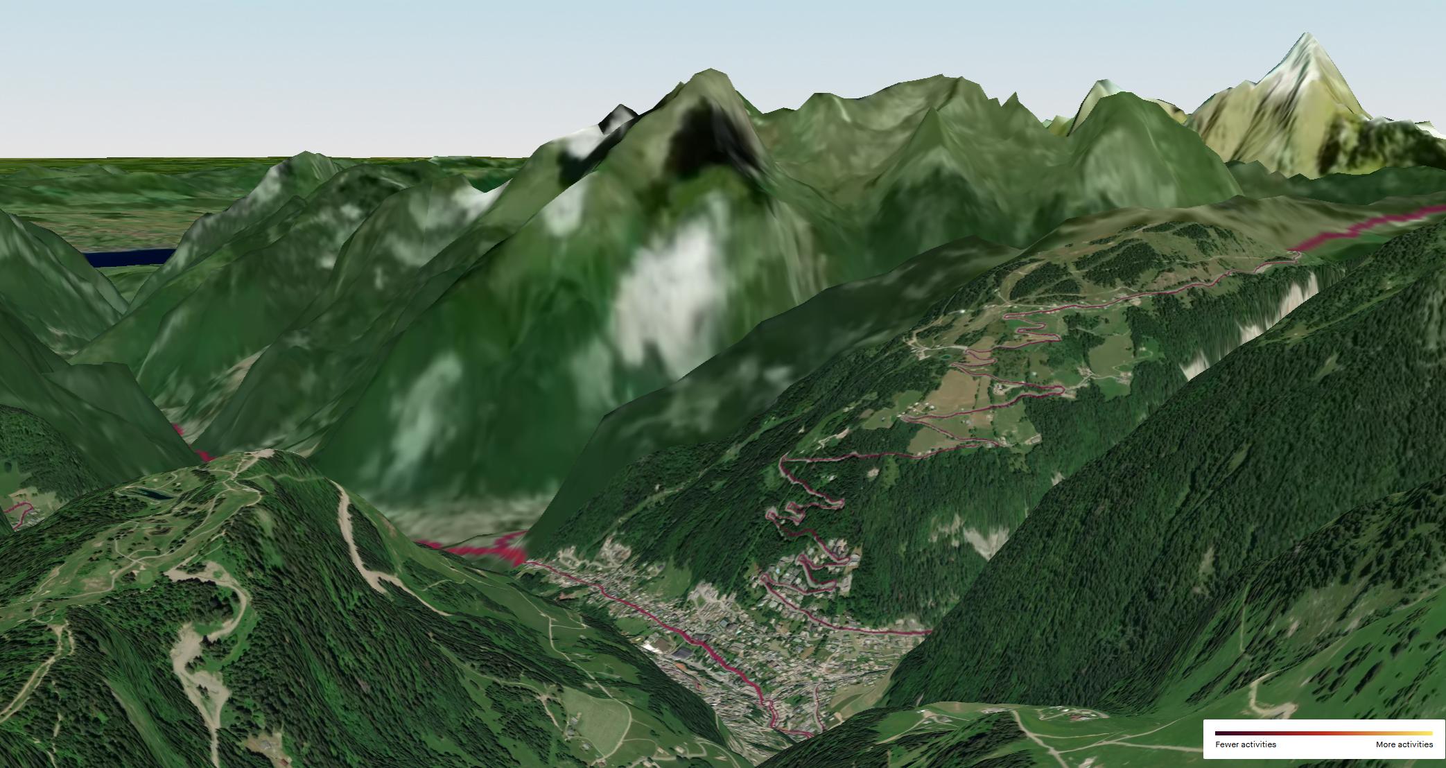
Perhaps on my usual less mountainous terrain, the results are somewhat less spectacular. Nevertheless, this new feature does add some additional context to your travels and I will use it from time to time. Plus it can be used to get some visual clues about which parts of your route were uphill or downhill when a 2D aerial views doesn’t quite so readily give you that view.
Note: This does NOT appear in the heatmap in the route planner.
New Satellite Maps (All users)
The image above might appear to have a different map to the one you are used to and you would be correct if that is what you thought. Last week Strava snuck out a new SATELLITE map provider as they integrated MAPBOX in favour of the Google and Apple options they used to use for this (Source: Strava).
Here is a before and now image showing just how much Mapbox improves the satellite display you will see on mobile or desktop. The images are also more recent and so the visual context is more likely to be closer to the world you experience.

These new satellite maps should be available to everyone over the entire Strava platform including heatmaps, activity recording and activity uploads.
Strava 2021 – Speculation on where this is heading
Strava has clearly invested in 3rd party satellite imagery and it’s not going to simply be for the purposes of what I’ve covered above. It will inevitably cover additional features that strava adds over time.
Keen followers of all-things-Strava will remember that RELIVE was effectively barred from the Strava ecosystem in July 2019. Relive seems to have done well since then as that action by Strava spurred them on to make other innovative partnerships. However, we speculated at the time that RELIVE’s removal from Strava was likely due to Strava planning to include similar functionality themselves and this month’s new Terrain maps support that view.
Here’s is what we MIGHT see from STRAVA soon
- 3D satellite imagery for population-heatmaps in route planning – This would be a useful feature in my opinion. In my look at today’s functionality, I found the 3D personal heatmap viewer somewhat slow. Whether that was my PC or the service I remain unsure. The point of mentioning that is that once thousands of you start using this feature for population-wide data I would imagine the server load and graphics load on your PC will both significantly increase. I’m sure Strava realises that.
- Strava will let you revisit previous rides in glorious 3D…a bit like Relive…but different. You will probably be able to share 3D achievements or routes with friends and, hopefully, Strava will overlay key workout metrics at key points in time over the maps in a similar way to what Polar has done here for several years.
Indeed Strava’s note to the press today included the line, “this marks the first extension of Strava maps into 3D“. Clearly more is planned.
3. However, I’m still hoping for more from Strava this year beyond 3D maps. My main bet would be a move to properly support running power. IE more than simply not confusing it with cycling power but rather to also include all the power metrics for subscribers that cyclists currently enjoy. That may well coincide with moves by Garmin with native running power, which is overdue.
new STRAVA Local Legends – Segments, Jim, but not as we know them
Sports Apps 2020 Report & Table – Winners & Losers of 2019 – Best Sports App
Something different? Why not check out my Apple Watch 7 review…it’s much more awesome than you think and only a battery and two buttons away from destroying Garmin’s market share. Just sayin’
Last Updated on 25 January 2026 by the5krunner
My favourite kit and nutrition
- Injinji – Runners protect your toes. Avoid discomfort and minor injury. Run more. run faster. I use them.
- Garmin 90-degree charging adapter — the small adapter that keeps your charging cables tidy. Essential for race day. I use one.
- Garmin charging puck — the fastest and most reliable way to top up your Garmin before a session. I use one.
- Ravemen FR300 — front light that mounts directly under your Garmin or Wahoo head unit. Keeps your bars clean and your beam pointed where it matters. I use one.
- Body Glide – The Blue anti-chafe stick that all swimmers and many runners use. I use it.
- Maurten — the race nutrition trusted by elite athletes. Gels and drink mix engineered to be easy on the stomach. I use them.
- Garmin Varia RTL515 — radar rear light that alerts you to vehicles approaching from behind. Pairs with your Edge or Garmin watch. I use this model.
- Favero Assioma Pro RS2 — the power meter pedals most serious cyclists end up choosing. Accurate, easy to move between bikes. I use this model.
Reader-Powered Content

This content is not sponsored. It’s mostly me behind the labour of love, which is this site, and I appreciate everyone who supports it.
Support the site: Follow (free, fewer ads) · Subscribe (paid, ad-free) · Buy Me A Coffee ❤️
All articles are written by real people, fact-checked, and verified for originality. See the Editorial Policy. FTC: Affiliate Disclosure — some links pay commission. As an Amazon Associate, I earn from qualifying purchases.
tfk is the founder and author of the5krunner, an independent endurance sports technology publication. With 20 years of hands-on testing of GPS watches and wearables, and competing in triathlons at an international age-group level, tfk provides in-depth expert analysis of fitness technology for serious athletes and endurance sport competitors. ID
