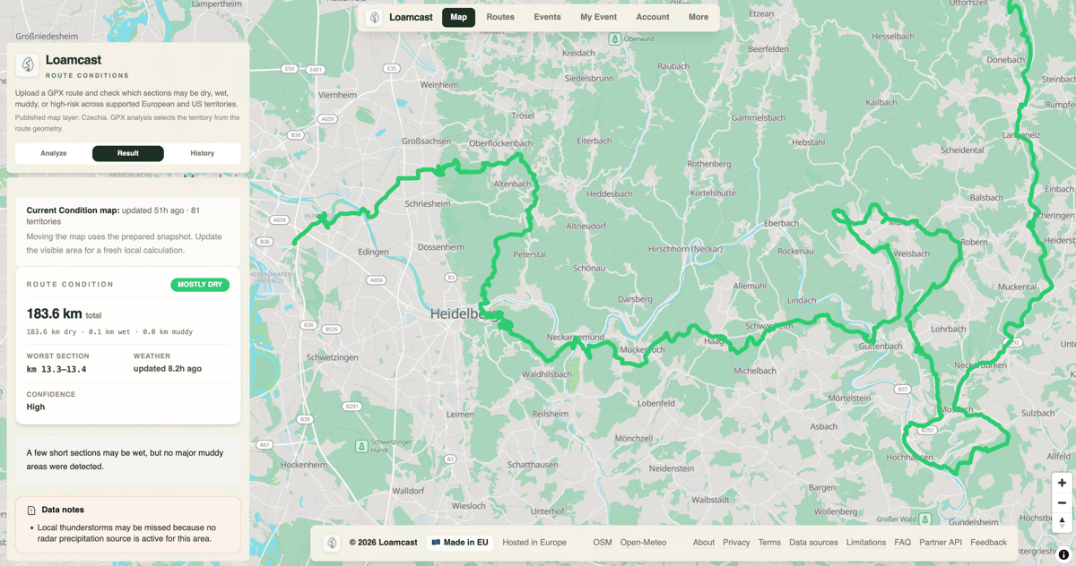
Many trail athletes plan long days several days in advance, whether for a gravel ride, a trail run, or a weekend hike. Checking the weather is easy. The difficult part is understanding what the weather has actually done to the route. A weather app can tell you it rained three days ago and that it is sunny now, but it cannot tell you whether a forest road has already dried or turned into mud.
Loamcast is built to answer that question. A user uploads a GPX file for a route, and Loamcast estimates the current condition of each section as Dry, Wet, Muddy, or High risk, displayed on the map.
Why the weather forecast is not enough
Imagine two trails a few kilometres apart receiving the same rain. One is an open gravel road on a slope where water runs off easily and the sun reaches it most of the day. The other is a flat dirt track inside a shaded forest close to a stream. By the following afternoon, the gravel road may already be dry while the forest track remains wet or muddy. Current sunshine does not mean the ground has dried, which is why Loamcast combines recent weather with surface, terrain, and surroundings to estimate what happened to the ground after the rain stopped.
How Loamcast works
TL;DR: Upload a GPX file, and Loamcast divides the route into shorter sections and estimates the moisture condition of each one directly on the map. One label for the whole route would hide the sections that matter most.
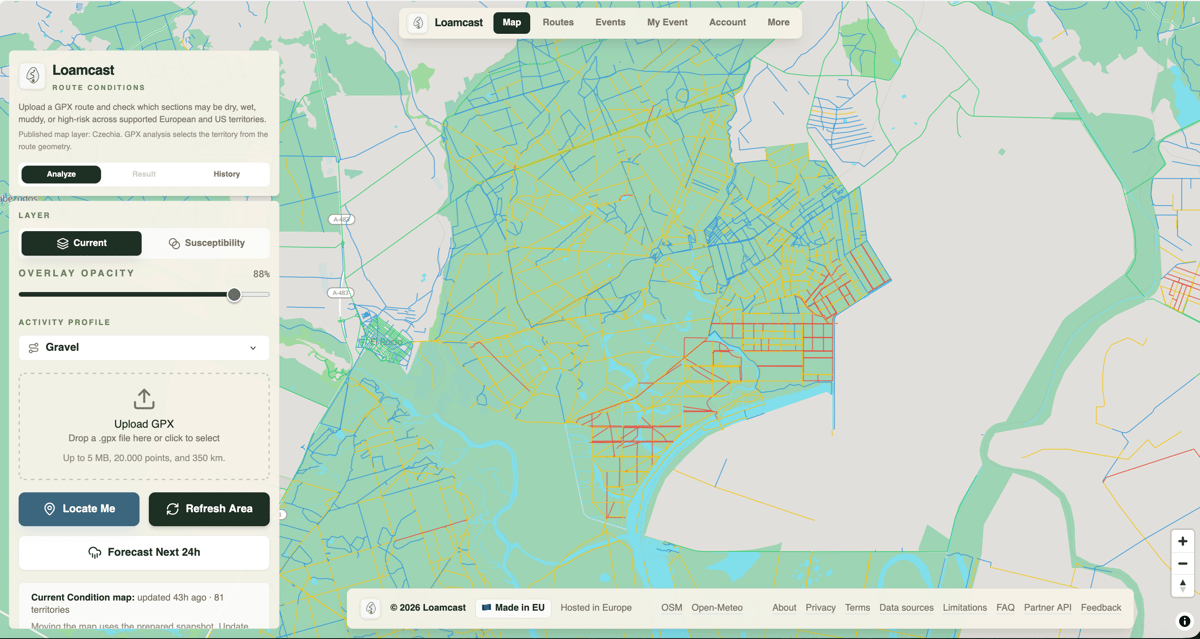
Loamcast uses four specific labels:
- Dry. Little surface moisture is expected to remain.
- Wet. Ground probably contains moisture, though it remains usable for running or cycling.
- Muddy. Surface is soft, slippery, and slower to cross.
- High risk. Strongest warning where moisture, drainage, and terrain combine to make the section significantly more difficult.
These are mathematical estimates rather than physical inspections. A Dry section can still contain a puddle, and High risk does not automatically mean impassable. The map marks which sections deserve more attention.
Why one road dries faster
For each road or trail section, Loamcast processes recent rain, temperature, humidity, road surface, soil type, slope, surrounding terrain, nearby water, tree cover, and freezing factors. All these variables affect how quickly water leaves the surface. A steep gravel road in the sun behaves differently from a flat dirt track inside a forest or a trail along a ridge.
The model is mathematical and deterministic, producing consistent results from the same data without guessing. This makes the output explainable: a section receives a worse rating due to a specific combination of recent rain, poor drainage, shade, or soft soil.
Current conditions come first
The main Loamcast map focuses on current conditions using recorded weather and environmental data. There is also a separate 24-hour outlook based on rainfall forecasts, though it functions as a planning aid rather than a guarantee. Weather forecasts may predict regional rain accurately while missing exact volumes or locations, and two millimetres versus fifteen millimetres produces drastically different ground conditions. For this reason, Loamcast avoids long-term seven to ten day surface forecasts where local rainfall data is not reliable enough.
The work behind the map
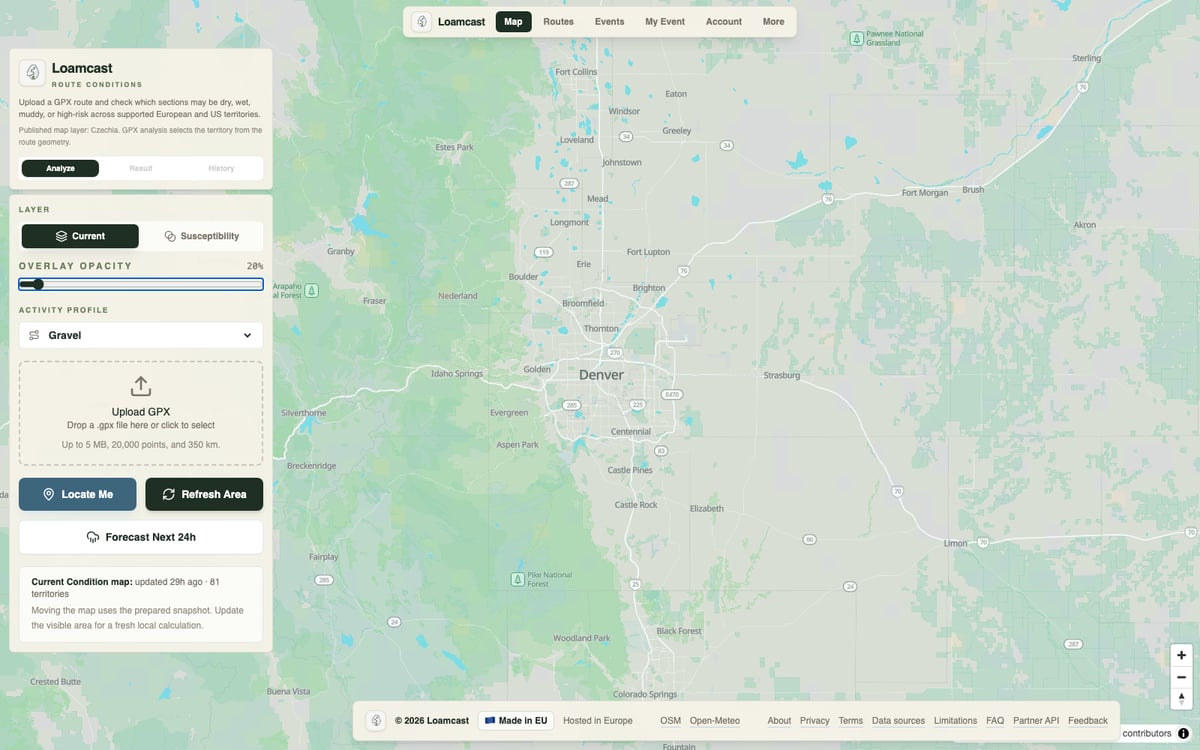
While the output map is simple, preparing the underlying data required substantial engineering. Loamcast currently supports 81 territories across 33 European countries and the 48 contiguous US states. Each territory relies on its own road networks, coordinate systems, and terrain data, including official LiDAR-derived elevation models where available (such as USGS sources in the US).
These datasets are downloaded, transformed, and connected to millions of road sections before a user ever uploads a GPX file. While elevation data does not explicitly state that a road is muddy, it reveals whether a path lies in a hollow, on a steep slope, or near a wetland, allowing the model to compute moisture behaviour. Processing large territories requires heavy storage and compute power. Texas alone required many terabytes of source data and intermediate terrain models.
What about satellites?
Loamcast incorporates an experimental evidence layer based on Sentinel-1 radar satellites. Radar penetrates clouds and rain day or night, making it useful for observing broader moisture patterns. However, satellites cannot watch every trail continuously. Narrow paths fall below image resolution, dense tree cover distorts signals, and ground can wet and dry between satellite passes. Sentinel-1 contributes evidence of persistent wetness across wider areas rather than detecting individual puddles.
Tested first in Czechia
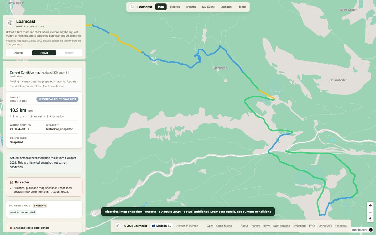
Loamcast developer Michail Chvjadcena is based in Czechia, where most field testing and model calibration took place across spring and summer rides. Comparing model outputs against real ground conditions helped refine how the algorithm factors in rainfall, forest cover, slope, and drying times. While Czechia is the primary locally calibrated market, technical coverage and terrain data are already active across all 81 territories. The current focus is expanding structured field testing across different climates and seasons to build a validation dataset before publishing universal accuracy metrics.
What Loamcast cannot know
No model can observe every local hazard. Loamcast cannot know if forestry machinery damaged a trail yesterday, nor can it detect a newly blocked drain, a fallen tree, or localised rain missed by weather stations. It answers the general question (“what is this section likely to be like?”) rather than the hyper-specific one (“is there a puddle behind the next corner?”). Official warnings and direct observation still apply.
Why this can be useful for trail runners and cyclists
Trail runners and cyclists mentally calculate ground conditions on familiar local routes based on recent weather and past experience. That mental model breaks down when travelling, entering events, or planning long routes through unfamiliar terrain. Loamcast provides an objective starting point, showing whether open sections are in better shape than forest tracks or where recent rain accumulated. Event organisers can also use the data to inform participants about course conditions ahead of race day.
What you can use today
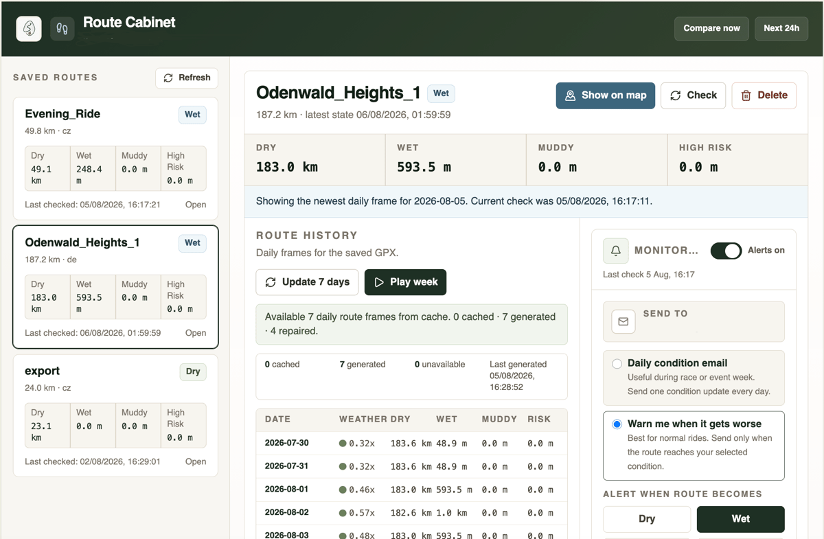
The public website at loamcast.com is currently free. After registering, a user can save and monitor up to three routes at the same time, with each GPX file supporting up to 350 kilometres. Saved routes can be monitored continuously, sending daily summaries or automated alerts via email when a meaningful part of a planned route degrades to Muddy or High risk.
An iOS version of Loamcast is currently in development to streamline field data collection. Users will be able to record actual surface conditions directly while moving along a route, allowing real-world observations to be matched against model predictions automatically. Weather stations, terrain models, and satellites provide extensive data, but they cannot replace direct ground truth from people on the trail.
Try it on a route you know
The most useful first test is to upload a GPX file for a route you know well and see how Loamcast identifies sections that take longer to dry. Compare the Wet, Muddy, or High risk markers against your own experience, then test it on an unfamiliar route where local knowledge is unavailable. Field observations and feedback from real rides are what the model needs as structured testing expands globally.
Quick answers
Which countries does Loamcast cover?
Loamcast currently covers 81 territories across 33 European countries and the 48 contiguous US states. Each territory has its own road network data, coordinate system and, where available, official LiDAR elevation models. Field calibration has focused on Czechia so far, with structured testing expanding across other climates and seasons.
Is Loamcast free to use, and what are the limits?
The public website at loamcast.com is currently free. After registering, a user can save and monitor up to three GPX routes at the same time, with each route up to 350 kilometres long. Saved routes can send daily summaries or automated email alerts when a section of a planned route degrades to Muddy or High risk.
How accurate is Loamcast in practice?
Loamcast produces mathematical estimates from weather, terrain, soil, drainage and tree-cover data rather than physical inspections. A Dry section can still contain a puddle, and High risk does not automatically mean impassable. Loamcast avoids long-range seven to ten day surface forecasts where local rainfall data is not reliable enough, and the developer is expanding structured field testing across different climates before publishing universal accuracy metrics.
Related reading on the5krunner
- Tooboo: Standalone Offline Outdoor Navigation on Apple Watch Ultra: another indie outdoor app for long-distance hiking and trail running, running offline on the watch.
- Awesome Maps: Ordnance Survey and Satellite Maps for Garmin CIQ: a small Connect IQ shop delivering premium hiking mapping to older Garmin watches.
- Train to Mountain: Adaptive Mountaineering Training: another indie outdoor app, adaptive training for the 3,000 to 5,000m mountain athlete.
Author: Michail Chvjadcena, developer of Loamcast, edited by the5krunner.
Last Updated on 6 August 2026 by the5krunner
My favourite kit and nutrition
- Garmin Fenix 9 Pro — I’ve just bought one.
- Injinji – Runners protect your toes. Avoid discomfort and minor injury. Run more. Run faster. I use them.
- Garmin 90-degree charging adapter — A small keyring adapter you can use anywhere. Essential when away. I use one.
- Garmin charging puck — the fastest and most reliable way to top up your Garmin before a session. I use one.
- Ravemen FR300 — Front light that mounts directly under your Garmin or Wahoo head unit. Keeps your bars clean and your beam pointed where it matters. I use one.
- Body Glide – The blue anti-chafe stick that all swimmers and many runners use. I use it.
- Maurten — The race nutrition trusted by elite athletes. Gels and drink mixes engineered to be easy on the stomach. I use them.
- Garmin Varia RTL515 — A radar rear light that alerts you to vehicles approaching from behind. Pairs with your Edge or Wahoo. I use this model.
- Favero Assioma Pro RS2 — The power-meter pedals most serious cyclists choose. Accurate, easy to move between bikes. I use this model.
- Garmin Forerunner 970 — A serious choice for a pro-grade triathlon watch. I use this.
- Polar H10 — My daily driver for accurate, waking HRV readings.
- Wahoo ELEMNT Roam 3 — The bike computer that has the feature Garmin lacks: usability. I use mine on most rides.
Reader-Powered Content

This content is not sponsored. It’s mostly me behind the labour of love, which is this site, and I appreciate everyone who supports it.
Support the site: Follow (free, fewer ads) · Subscribe (paid, ad-free) · Buy Me A Coffee ❤️
All articles are written by real people, fact-checked, and verified for originality. See the Editorial Policy. FTC: Affiliate Disclosure — some links pay commission. As an Amazon Associate, I earn from qualifying purchases.

tfk is the founder and author of the5krunner, an independent endurance sports technology publication. With 20 years of hands-on testing of GPS watches and wearables, and competing in triathlons at an international age-group level, tfk provides in-depth expert analysis of fitness technology for serious athletes and endurance sport competitors. ID
