Hiking Technology: Navigation, Safety and the Trail
Hiking sits at the intersection of almost every technology this site has tested for a decade: GPS accuracy under canopy and on open ridgelines, satellite communicators that have coordinated documented rescues, solar charging for trips that outlast any battery, and environmental sensors that have warned, and occasionally failed to warn, of incoming weather. No other activity demands this range from a single device, or this honesty about where the technology falls short. This article maps that complexity based on the site’s own testing and reporting, and links to the posts that contain the details.
Navigation and Mapping
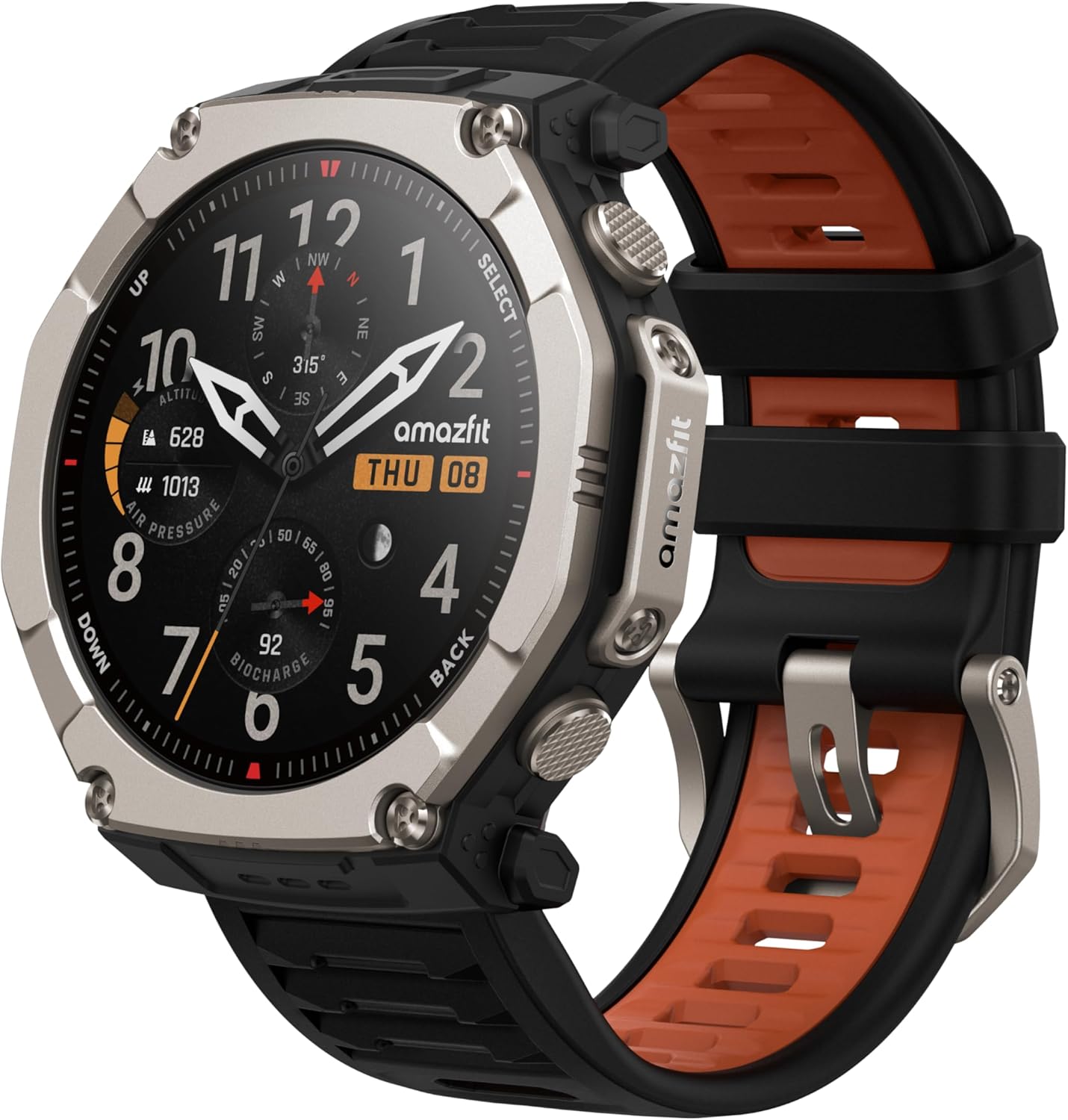
The quality of the map on the wrist determines the quality of the decision on the trail. Routable topographic maps arrived on Garmin Fenix watches with the Fenix 5 Plus and are now standard across the Fenix 8 series, the Enduro 3, and the GPSMAP H1i Plus handheld. The Garmin Instinct 3 supports maps as a 3rd-party add-on rather than out of the box, a distinction worth knowing before purchase. The Amazfit T-Rex Ultra 2 now beats the Instinct 3 on out-of-the-box mapping at a similar price. Garmin retains a measurable lead on GPS track precision and elevation accuracy on complex terrain, but the gap at this price tier has narrowed.
For Apple Watch users, Komoot’s standalone watchOS app handles turn-by-turn navigation without a paired phone, tested here on the Ultra 3. It is a credible option for day hikers already in the Apple ecosystem, but not a replacement for Garmin’s native, subscription-free legacy mapping.
If you are interested in precision location while hiking, we have rigorous and longitudinal tests across Garmin, Coros, Suunto, and Amazfit devices, all of which are available in the GPS accuracy hub.
Several Garmin navigation features are worth knowing by function:
- NextFork displays the distance and name of the next trail intersection directly on the map screen, removing the need to stop and check a phone.
- Up Ahead shows a rolling list of upcoming waypoints, water sources, and campsites along a loaded route with exact distances remaining to each.
- TracBack reverses the active journey and navigates along it back to the start – no preloaded course required.
- Around Me filters nearby summits and points of interest from the current map view for spontaneous route decisions.
- Sight ‘N Go locks a compass bearing on a visible landmark for precise off-trail navigation toward that target.
- SatIQ automatically manages power consumption for multi-band GNSS, switching between dual-frequency and single-frequency to match the needs. The accuracy trade-off this involves is covered in detail in the GPS accuracy hub.
Garmin’s subscription layer adds two further navigation products. Garmin Connect+ ($6.99/month or $69.99/year) includes Trails: curated trail discovery with difficulty filters, elevation profiles, and crowd data. At launch, the Trails database was strong in the United States and near-empty across most of the UK and Europe so check the current status before subscribing. Outdoor Maps+ is a separate product giving access to premium topographic maps, satellite imagery, and Trails within the Garmin Explore smartphone app. Both sit atop the base mapping capability, which remains free on compatible hardware. For route planning outside Garmin’s ecosystem, the Strava hub covers Komoot, Strava routes, and RideWithGPS. For Garmin watches without an onboard map, plan and sync a route on the Explore app and follow the breadcrumb on your watch.
One failure is worth recording. A software update in December 2025 rendered trails near-invisible on the Fenix 8 Pro and Enduro 3 during active navigation. The fault survived every firmware update for at least two months. No other publication reported it in real time. It is a useful reminder that premium mapping hardware depends entirely on the software rendering it.
Research into how humans navigate independently of technology is also worth knowing for when visibility is impaired. The brain’s internal GPS has a documented design flaw that causes a consistent underestimation of distance on complex terrain — precisely where wrist-based navigation adds the most value.
Elevation, Climbing and Pacing
ClimbPro automatically detects uphill sections in a loaded course and opens a dedicated screen that shows real-time gradient, remaining ascent, and the distance to the top of each climb. For a multi-hour ascent, knowing precisely how much remains to be done changes your pacing plan and energy management. Grade-Adjusted Pace (GAP) works alongside it: GAP translates current pace over steep terrain into an equivalent flat-ground effort, allowing consistent energy output across prolonged climbs without the guesswork of perceived exertion on variable gradient. Used together, they give a hiker the same pacing intelligence that road runners get from running power or the same GAP metric.
Accurate elevation data underpins all of this.
Every serious hiking watch now combines barometric altimeter readings with 3D GPS altitude positioning in real time – Suunto branded this approach FusedAlti when it introduced it with the original Spartan series, and the principle has since become standard across Garmin, Coros, Amazfit, and Apple hardware. Brands use different marketing names: Amazfit recently described dead reckoning on the Cheetah 2 Ultra as a novel feature, when it is the same sensor-fusion principle that every other platform already applies in canyons and under dense canopy. What matters in practice is implementation quality, and the site’s elevation accuracy data – collected across the Fenix 8, Instinct 3, T-Rex Ultra 2, Suunto Vertical, and Coros Vertix 2 – shows measurable differences between platforms on sustained climbs. Garmin’s GPS-calibrated barometric altimeter maintains altitude more consistently than Amazfit’s implementation during prolonged ascents, where the latter tends to drift. That data is in the GPS accuracy hub.
For the physiology behind altitude and its effects on the body, the recovery tracker hub covers SpO2, HRV, and sleep architecture as markers of physiological stress at elevation.
Off-Grid Safety and Satellite Rescue
Garmin confirmed more than 3,000 inReach SOS incidents in 2025. Hikers account for over a third of all callouts, the largest single activity category in the rescue data. When an SOS is triggered, Garmin Response, the company’s own 24/7 monitoring centre, coordinates with local search and rescue, continuously tracks the device, and maintains two-way text communication with the casualty throughout the operation.
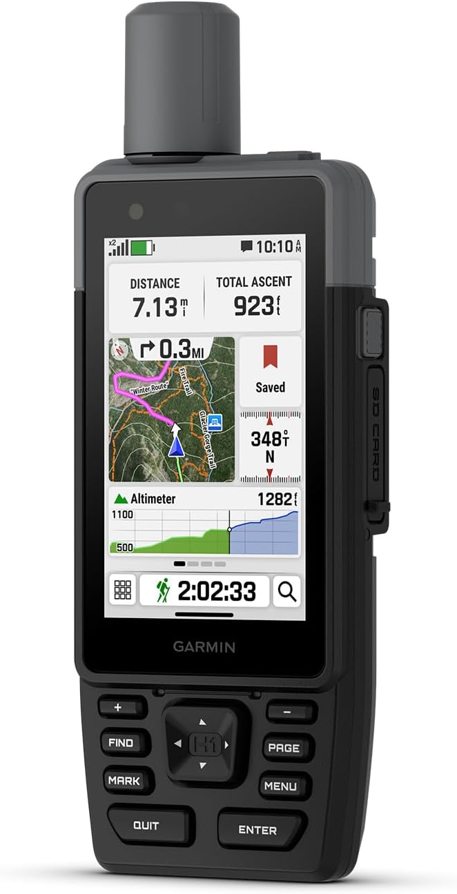
The inReach Mini 3, released in late 2025, adds a colour touchscreen and optional voice and photo messaging to the compact communicator format. The GPSMAP H1i Plus brings inReach Plus technology to a dedicated handheld: a 3.5-inch sunlight-readable touchscreen, physical buttons for gloved operation, and up to 145 hours of battery life, all at $999.99. Both devices materially change the Search and Rescue (SAR) dynamics. Giving Garmin Response coordinators a photograph of the situation or the ability to speak with a casualty improves rescue triage in ways that a coordinate ping cannot.
The Fenix 8 Pro integrates inReach directly into the watch. It requires a mandatory subscription, starting at $7.99 per month, to activate satellite messaging and SOS. A lesser-known Enabled Plan reduces that cost substantially for seasonal users. The site’s complete inReach SOS guide covers activation, rescue coordination, financial liability, and the full range of subscription options. Multi-device support, added in late 2025, removes the previous requirement to deactivate one device when adding another to an account; each active device still requires its own subscription.
The Apple Watch Ultra 3 carries free satellite Emergency SOS – no subscription required – via Apple’s own satellite network. For the weekend adventurer who occasionally goes off-grid rather than the dedicated expedition hiker, this is a significant safety capability: one-touch SOS from the wrist, at no ongoing cost beyond the watch itself. It does not replicate two-way messaging or the Garmin Response coordination layer, and Apple’s satellite coverage differs from Garmin’s by region. But as a safety net for day hikers and weekend trips, it removes the cost barrier that has historically kept satellite SOS on a separate device. The full comparison of Apple and Garmin satellite implementations is in the Fenix 8 Pro vs Ultra 3 satellite showdown.
LiveTrack broadcasts real-time location and planned route data to nominated contacts via an automated link when the device is within cellular range, or via a paired inReach device when it is not. It is not a rescue tool, but it is the most practical daily safety measure available to solo hikers operating within normal connectivity range.
The Garmin inReach coverage map shows satellite availability by region. For buyers whose decision depends on off-grid safety, the analysis of the four critical failures in the Fenix 8 Pro’s satellite implementation is required reading before purchase.
Battery, Solar and Multi-Day Trips
A three-day trip exposes battery claims to conditions that specification sheets do not describe. The practical summary for device selection:
- Fenix 8 Solar 51mm: up to 68 hours GPS, extending further in sustained sunlight. The correct choice for trips of two or more days without reliable charging access.
- Fenix 8 Pro MicroLED: drops to 15 hours GPS with an always-on display active. A poor choice for extended off-grid use.
- Fenix 8 AMOLED: up to 47 hours GPS under full multi-band load. Suited to trips where charging is available and display quality matters for navigation in low light.
- Enduro 3: the site’s coverage describes battery and mapping as second to none in the current generation. The correct answer where endurance is the single defining constraint.
- Coros NOMAD and Amazfit T-Rex Ultra 2: competitive multi-day battery without solar charging, at prices below equivalent Garmin hardware.
The site’s deep analysis of Garmin solar technology and the separate battery life piece cover the underlying architecture: how Power Glass works, what solar yield is realistic in UK and northern European conditions, and why published figures require context rather than face-value acceptance.
Environmental Awareness
ABC sensors — altimeter, barometer, and compass — are standard on every serious hiking watch from Garmin, Suunto, Polar, Coros, and Amazfit’s adventure line. Storm Alerts on Garmin devices continuously monitor the barometric sensor and trigger a notification when a rapid pressure drop indicates an incoming weather front. Practical reliability of these alerts in field conditions is discussed in the Fenix 6, Suunto 9 Peak, and Apple Watch Ultra reviews on this site.
On Pulse Ox and altitude acclimatisation: all current flagship hiking watches carry a SpO2 sensor. The site’s coverage documents sensor availability across devices. Readers planning high-altitude expeditions should treat wrist-worn SpO2 as a directional indicator rather than a clinical measurement. The heart rate hub covers optical sensor accuracy and its limitations in more detail.
Durability
MIL-STD-810 is the durability baseline for serious hiking hardware. Current devices meeting that standard include:
- Garmin Fenix 8 Solar and Pro
- Garmin Instinct 3
- Garmin Tactix 8
- Amazfit T-Rex Ultra 2
- Coros NOMAD
- Polar Grit X2 Pro Titan
IP68 is sufficient for rain and stream crossings. 10ATM covers full submersion. The T-Rex Ultra 2 review on this site covered two months of sustained outdoor use. The NOMAD review covers Coros’s most rugged device in comparable detail.
Rucking
Garmin added a native Rucking activity profile in late 2024, with pack weight input arriving on the Tactix 8 and Garmin Instinct 3. Entering pack weight adjusts calorie estimates and strain metrics to account for the metabolic cost of carrying a load, producing more accurate training data than a standard hiking profile for anyone using weighted carry as a deliberate training stimulus. Amazfit added a comparable mode to the T-Rex 3 and Balance 2 in December 2025. Coverage on this site tracks both implementations; however, there is no original testing of rucking yet.
Which Device for Which Hiker
Day hiking. The Garmin Instinct 3 Solar with maps added via Explore covers the essentials at a price well below the Fenix 8 line. The Amazfit T-Rex Ultra 2 is the strongest alternative in this price range, with better out-of-the-box mapping. Apple Watch Ultra 3 with Komoot handles day hiking competently within the Apple ecosystem, and its free satellite Emergency SOS removes the cost barrier for off-grid safety on occasional trips; battery limits it to a single long day.
Mountain and multi-day. The Fenix 8 Solar 51mm for most users: 68 hours GPS, full routable maps, ClimbPro, storm alerts, and MIL-STD-810 without a mandatory subscription. The Enduro 3, where the battery is the dominant constraint. The Coros NOMAD is available at a lower price point than either.

Expedition with satellite safety. The Fenix 8 Pro integrates inReach directly, removing the need for a separate communicator, at the cost of a mandatory ongoing subscription. The inReach Mini 3, paired with a Fenix 8 Solar, offers the same capabilities with greater flexibility in subscription timing and a lower combined device cost if LTE is not required.
Handheld navigation. The GPSMAP H1i Plus, when wrist form factor is not the priority: a 3.5-inch screen, 145 hours of battery, full inReach Plus satellite communication, and physical buttons for gloved operation. At $999.99, it is the most capable single device Garmin currently makes for combined off-grid navigation and communication.
Free SOS on Suspended Plans
Garmin has since updated its suspension policy. Users who pause their inReach subscription now retain satellite SOS access for up to 12 months at no charge. The change applies to the Mini 2, Mini 3 series, and Fenix 8 Pro satellite plans. The original Mini 1 is excluded.
The 12-month cap matters. A plan suspended in June lapses for SOS purposes the following June. Verify your status before heading out if you have been off-plan for an extended period.
For full details see inReach SOS now free as Garmin struggles to match Apple.
Quick answers
Does the Garmin Fenix 8 require a subscription for satellite SOS?
The standard Fenix 8 and Fenix 8 Solar do not include inReach and do not require a subscription. They pair with a standalone inReach device for satellite SOS. The Fenix 8 Pro has inReach built in and requires a subscription starting at $7.99 per month to activate it. A lesser-known Enabled Plan is available at a lower cost for seasonal users.
What is the difference between Garmin Connect+ and Outdoor Maps+?
Garmin Connect+ ($6.99/month or $69.99/year) is a fitness and smartwatch subscription that includes the Trails trail discovery feature, AI coaching, and a performance dashboard. Outdoor Maps+ is a separate product giving access to premium topographic maps, satellite imagery, and Trails within the Garmin Explore app. Base topographic maps on compatible devices are free and require no subscription.
Which Garmin watch is best for hiking?
For day hiking, the Instinct 3 Solar with add-on maps. For multi-day hiking, the Fenix 8 Solar 51mm. For expeditions where satellite safety is the priority, the Fenix 8 Pro is the choice. For maximum endurance, the Enduro 3. The buyer’s guide section above maps each use case in detail, and the Garmin Fenix hub and Garmin Instinct hub cover the respective model lines in full.
Does the Apple Watch Ultra 3 work for hiking?
Competently for day hiking, with Komoot’s standalone navigation app and free satellite Emergency SOS built in at no extra cost. Battery limits it to single long days rather than multi-day trips, and it does not replicate Garmin’s two-way inReach messaging. The full picture is in the Apple Watch hub.
What does TracBack do on a Garmin watch?
TracBack records the GPS breadcrumb trail of the active session and, when activated, navigates back to the starting point along the same route. It requires no preloaded course and works from the device’s own recorded track. Particularly useful for out-and-back routes in poor visibility or when conditions change on the return leg.
How does Garmin inReach SOS work?
Holding the SOS button initiates a satellite connection to Garmin Response, the company’s 24/7 monitoring centre. Garmin Response confirms the alert, begins tracking the device in real time, and contacts local search and rescue. Two-way text messaging continues throughout the operation. On the inReach Mini 3 and GPSMAP H1i Plus, voice and photo messaging are also available during an active incident. The complete guide on this site covers activation, coordination, and costs in full.
Further Reading on This Site
Navigation and Mapping
- Amazfit T-Rex Ultra 2 Review: Out-Maps Instinct 3, Under-Prices Garmin Fenix
- Garmin Instinct 3: How to Get Maps
- Fenix 8 Pro Owners Can’t See Trails: Two Months Later, Nothing Has Changed
- Komoot Apple Watch App Review: Standalone Navigation Tested on the Ultra 3
- How AllTrails Will Take Advantage of T-Mobile and Starlink
- Garmin Trails Subscription: What You Get and What You Don’t
- Garmin eTrex Touch: A Comprehensive Buyer’s Guide
- Garmin GPSMAP H1i Plus: Handheld GPS for Off-Grid Adventures
- Why the Brain’s Internal GPS Has a Design Flaw
Off-Grid Safety and Satellite Rescue
- Garmin inReach SOS: The Complete Guide to Activation, Rescue Coordination, and Costs
- Garmin Fenix 8 Satellite SOS, Hiking Rescues and inReach 2025
- Garmin inReach Mini 3: All You Need To Know
- Garmin inReach: The Hidden Subscription Plan That Lowers Your Cost
- Garmin inReach Multi-Device Support: Full Breakdown
- Garmin Fenix 8 Pro vs Apple Watch Ultra 3: Satellite and Connectivity Showdown
- The Fenix 8 Pro Is Not Your Adventure Watch: Four Critical Failures Explained
- Garmin Hikers Account for Over a Third of inReach SOS Callouts
Battery and Solar
- Garmin Solar Technology: Deep Dive into Power Glass, MIP, and the Forever Battery
- Garmin Battery Life: Seeking Infinity
- Coros NOMAD Review
- Garmin Enduro 3: First Thoughts
Environmental Awareness and Durability
- Polar Grit X2 Review
- Polar Grit X2 Pro Review including Titan Edition
- Suunto Vertical Review: Onboard Maps
- Suunto Vertical 2: AMOLED, Flashlight, and 65-Hour GPS
- Merrell Moab 3 Mid GTX Hiking Boot Review
Rucking
- Garmin Instinct 3: You Rucked, They Answered
- Rucking and Pack Weight on Garmin Tactix 8
- Garmin Adds Rucking Support
Related Hubs
- Garmin Fenix Series Hub
- Garmin Instinct Series Hub
- Garmin Edge Series Hub
- GPS Accuracy Hub
- Heart Rate Hub
- Strava Hub
- Apple Watch Hub
- Recovery Tracker Hub
- Apple Watch Ultra 3: Detailed Review
- Garmin Fenix 8 Review
Explore the full resource library
This site covers endurance sport technology across a range of dedicated reference sections. Each one collects the most relevant articles, tests, and analysis on its topic in one place.
Brand and product guides
- Amazfit — the full Amazfit range from Balance to Cheetah to T-Rex, accuracy tests, HYROX partnership, and Zepp Health analysis
- Apple Watch for Sport — athlete-first coverage of Apple Watch across running, cycling, and triathlon
- COROS — watches, features, and firmware across the full COROS range
- Garmin — the company, the platform and the full range, and the starting point for choosing across every Garmin product line
- Garmin Edge — bike computers from entry-level navigation to flagship endurance and mountain biking
- Garmin Fenix — every model, feature, and firmware development for Garmin's flagship outdoor watch
- Garmin Forerunner — the full Forerunner line covered from entry level to triathlon flagship
- Garmin Instinct — rugged GPS watches for endurance and adventure athletes
- Garmin Features Explained — how Garmin's metrics work, from Training Load and Body Battery to Race Predictor and HRV Status
- Polar — watches, sensors, Polar Flow and training science across the full Polar range
- Suunto — Race, Vertical, Run and the SuuntoPlus ecosystem
- Strava — features, privacy, segments, and how Strava fits into a serious training setup
- Wahoo — KICKR trainers, ELEMNT bike computers, and the Wahoo ecosystem
- WHOOP — strain, recovery, sleep and the full WHOOP ecosystem
Sport and topic guides
- Running Watches — how to choose by discipline: road racing, trail, track, beginner, and multisport
- Triathlon and Multisport Technology — watches, sensors, and race-day tools for swimmers, cyclists, and runners
- HYROX — training science, race analysis, and technology for the functional fitness race format
- parkrun — technology, training, and performance for the weekly 5K
- Hiking Technology — navigation, safety, and trail tech for walkers and hikers
- Heart Rate Monitoring — optical sensors, chest straps, accuracy comparisons, and how to set training zones
- GPS Accuracy — how satellite systems perform across brands, terrains, and conditions
- Recovery Trackers — WHOOP, Oura, and the science of readiness scoring
- Female Athlete Tech — wearables, physiology, and performance for female endurance athletes, covering cycle-synced training, RED-S, HR accuracy, and VO2max
- Sports Science — peer-reviewed research on HRV, VO2max, lactate threshold, running power, wearable accuracy, and supplementation
- Testing Methodology — how this site tests GPS accuracy, heart rate, battery life, and other performance claims
Content series
- Release Radar — confirmed launches, leaks, and rumours across Garmin, Apple, COROS, Polar, Suunto, and Wahoo
- Deep Dive Feature Files — weekly firmware feature updates across all brands (bug fixes excluded)
- Fix Files — weekly firmware bug fix tracking across all brands
